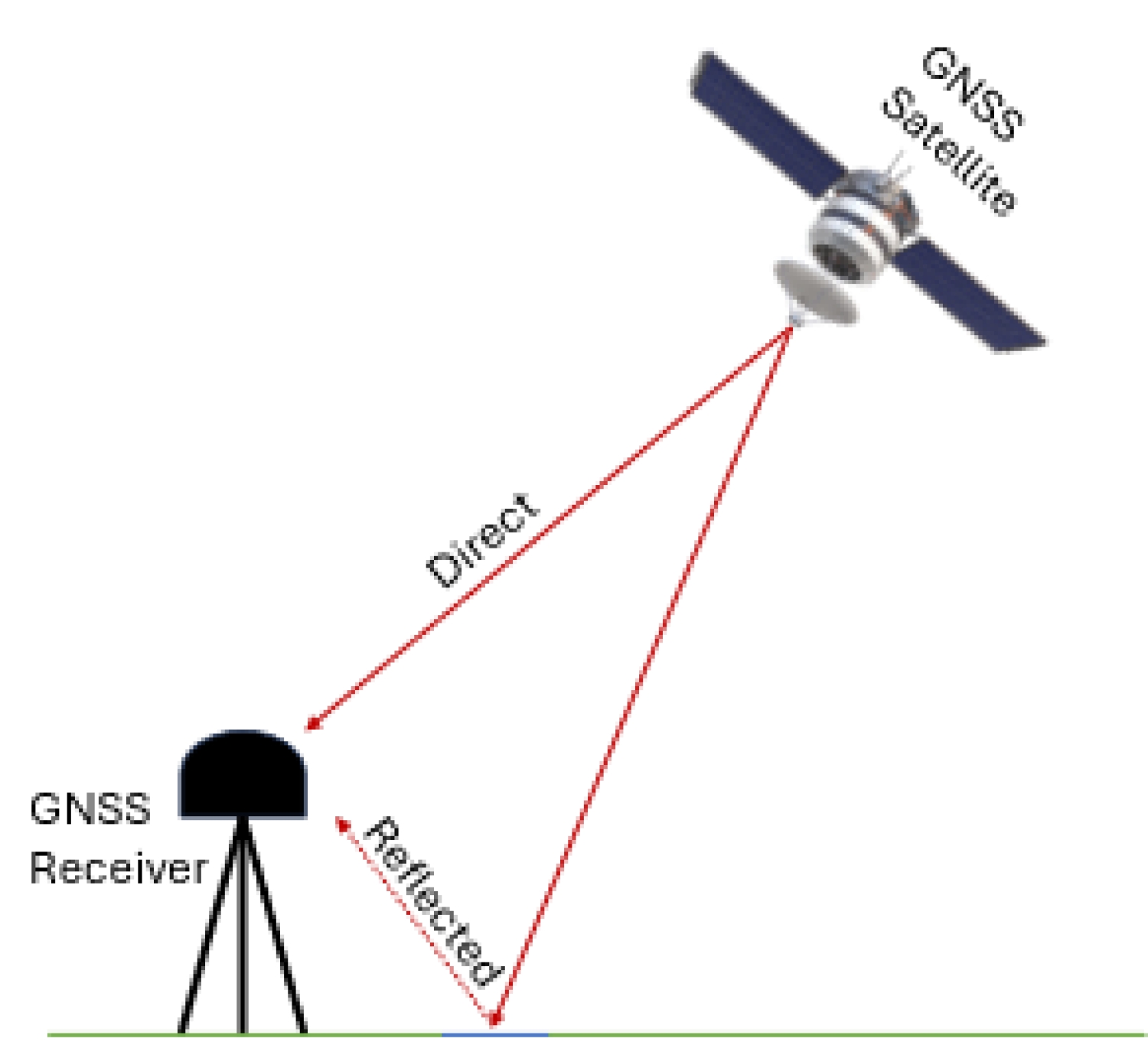
This is how GNSS users—through applications such as Google Maps—can accurately localize themselves. More than 100 GNSS satellites from different constellations broadcast their signals continuously to provide global coverage and minimize service interruptions. This presents an opportunity to utilize the signals transmitted by GNSS satellites to analyze other properties of the Earth's surface by combining observations of the received direct signal and the reflected signal (see Fig. 1).
This method, commonly known as GNSS-Reflectometry (GNSS-R), was first proposed in [1] to measure sea level. Since then, GNSS-R has been used for different applications, including measuring soil moisture, vegetation, and snow thickness. At its core, GNSS-R is based on the concept that other surfaces have different dielectric properties. For instance, wet soil has a higher dielectric constant than dry soil; therefore, the signal's power reflected from different surfaces would vary. This variation can then be analyzed to understand the effect of different surface properties on the reflected signal power.
The appeal of the GNSS-R method lies primarily in its continuity and affordability. It offers continuity because GNSS signals are continuously broadcasted, and it is affordable since no additional transmitter is required. The GNSS-R receiver can also be integrated into a LEO satellite payload, enabling broader coverage rather than remaining stationary on the ground.
References
[1] Martín-Neira, M. (1993): A passive reflectometry and interferometry system (PARIS): Application to ocean altimetry. ESA Journal, 17, 331-355.