We can barely get around much without referring to maps that use the Global Navigation Satellites System, commonly known as the GNSS. But have you ever wondered how these satellites know their positions or paths without having maps to refer to themselves?
The answer begins from the very moment a space mission is planned. Navigating a satellite or any spacecraft to the desired location in the vast expanse of space requires a team of scientists and engineers using sophisticated radios, large antennas, computers, and precise timing equipment. The prerequisite of navigating space is navigating Earth itself. The first phase is the Mission design phase, in which the team plans the spacecraft’s course and pinpoints the locations of planets and moons whose gravitational forces will affect its trajectory.
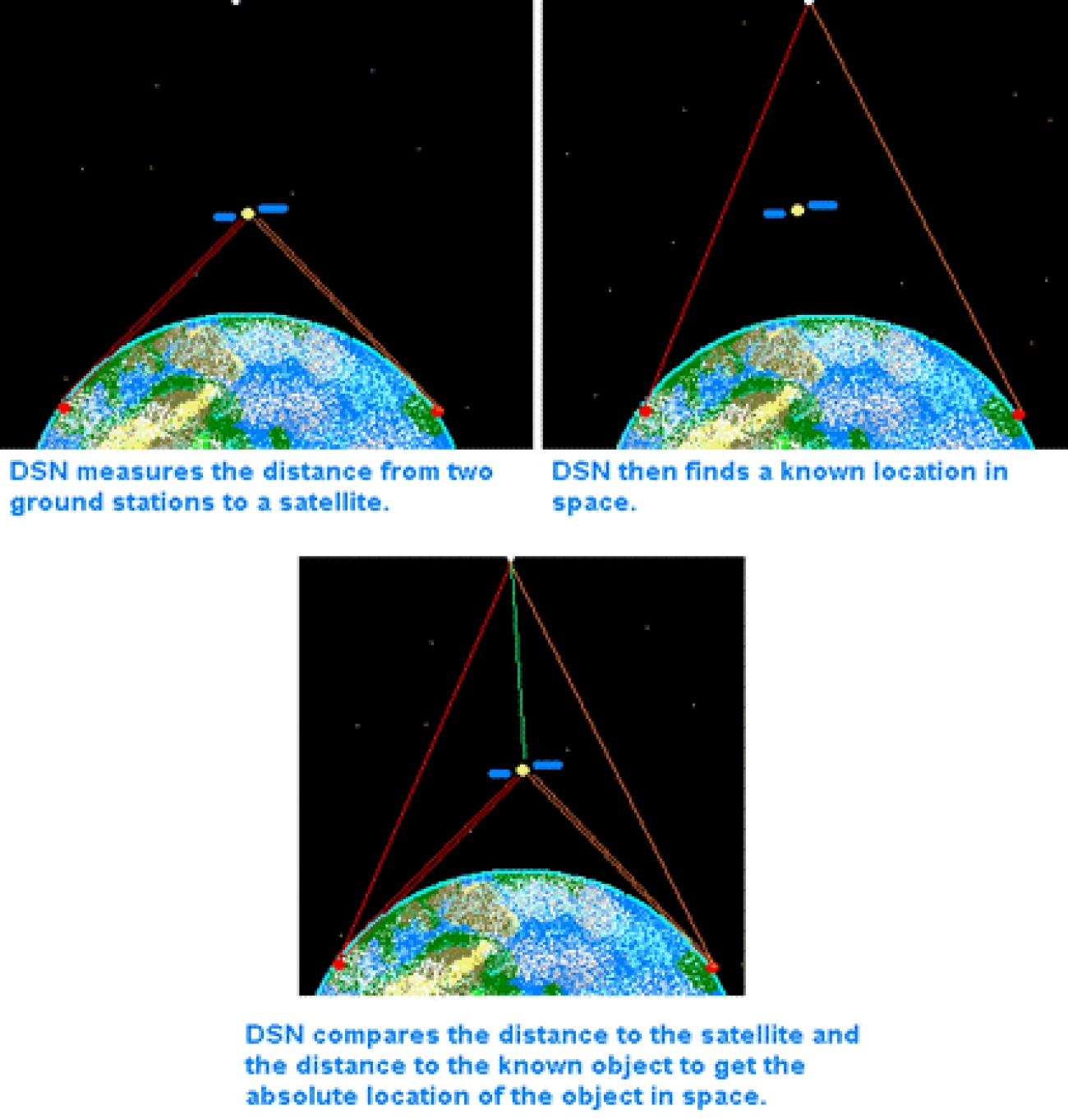
Like locating landmarks to confirm that we are indeed in the right place on Earth, a similar map of celestial landmarks helps us understand the location and orientation of the spacecraft in question. The first such map, the International Celestial Reference Frame (ICRF), was completed in 1995. This map consists of a collection of remote quasars whose positions in the sky are known precisely. We need objects so remote that their motion is not detectable. They also need to be far enough for this to occur and bright enough to be seen. This is why things like quasars, typically brighter than a billion suns, can be used.
Once all this information is collected and assessed, the orbit and maneuvers a spacecraft needs to make to arrive at its destination can be calculated and stored as instructions in the satellite or saved as a collection of commands known as the mission command sequence. After the spacecraft’s launch, we get into the second phase, orbit determination. The main purpose of this phase is to keep track of the spacecraft’s position in real-time during its flight motion. This process is important as a spacecraft rarely sticks to its original flight path due to disturbances from gravitational fields of unobserved small celestial bodies or solar pressure and other random matter interactions. These small deviations in its way quickly compound in space, leading to major course deviations over time, which may even cause the spacecraft never to reach its desired location.
To avoid all these issues, a spacecraft's orbit is tracked using multiple options like tracking radars, detection radars, optical telescopes, and imaging radars. Sometimes, GPS signals can also be used to locate a spacecraft, but this method is mainly used in Low Earth Orbits (LEO) and cannot be used in Deep Space Missions. In general, the Deep Space Network (DSN) is used for communication and navigation purposes for these kinds of long-haul missions. The DSN has a collection of large dish antennas that locate the spacecraft by sending precisely timed signals and measuring the time it takes for the signs to be received and retransmitted back to Earth. As these signals travel at the fixed speed of light, we can find out the distance of the spacecraft using the time delay.
The Doppler effect is used to increase the accuracy of these results. If a spacecraft moves in a direction away from the Earth, radio waves from it will get spread out, and if it moves towards the Earth, the radio waves will be scrunched together. These changes depend on the speed of the spacecraft. This makes it possible for the radio telescopes of the DSN to measure spacecraft speeds to within hundredths of a millimeter per second.
Another method commonly used is optical navigation, in which the spacecraft equipped with imaging instruments can use them to observe the spacecraft’s destination planet or other body, such as a satellite, against a known background star field, which can provide an estimate of the spacecraft's position.
Finally, with the help of the information about the state of the spacecraft, which is gathered from the initial parameters of the mission design phase and the insights from the orbit determination phase, any corrections or maneuvers needed to achieve the ideal flight path are incorporated in the third and last phase, that is the flight path control. Here, any changes to the flight path are calculated in terms of a change in velocity, also called delta v. This parameter decides the engine firing or rocket thrusting parameters of the spacecraft, which eventually helps it find its way back on the destined celestial journey.


